
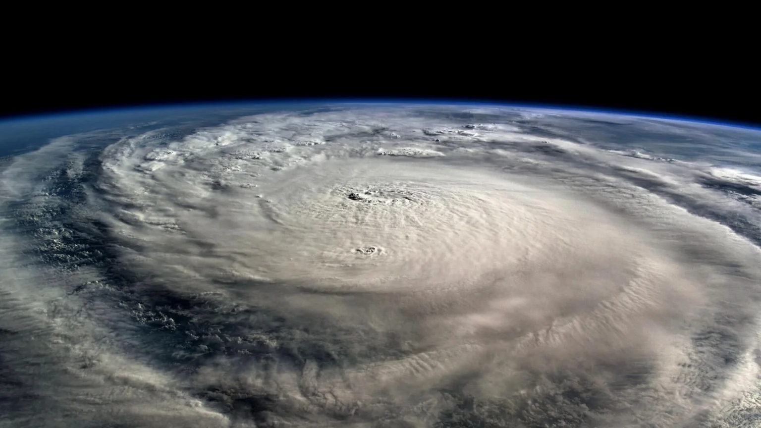
The Pacific hurricane season is once again reminding coastal residents and island communities of its unpredictable power. This time, all eyes are on Hurricane Kiko, a storm system that has steadily gained strength over the open waters of the eastern Pacific. Forecast maps now show Kiko moving on a trajectory that could bring it closer to Hawaii, raising concerns for both residents and officials. While the storm’s exact path remains uncertain, its steady westward drift has intensified the urgency of monitoring, preparing, and understanding its potential impacts.
- Understanding Hurricane Kiko
- Hurricane Path and Forecast Models
- Hawaii’s Storm Preparedness
- The Role of Climate Change in Pacific Hurricanes
- Travel and Tourism Concerns
- Economic Implications of the Storm
- Forecast Uncertainty and the Science Behind It
- Community Voices and Human Stories
- FAQs About Hurricane Kiko
- What is the current status of Hurricane Kiko?
- Is Hawaii directly in the path of Hurricane Kiko?
- What preparations should Hawaii residents make for Hurricane Kiko?
- How does Hurricane Kiko compare to past Hawaiian hurricanes?
- How is climate change influencing storms like Kiko?
- Conclusion
In recent decades, Hawaii has found itself in the crosshairs of several dangerous storms, from Hurricane Lane in 2018 to Hurricane Douglas in 2020. Kiko, though still hundreds of miles away, is stirring up similar anxieties. Beyond the immediate concerns, the storm’s development also provides a valuable case study on how climate patterns, warming oceans, and atmospheric shifts influence tropical cyclone behavior. By examining Hurricane Kiko’s path and forecast maps, residents, travelers, and climate observers can gain a deeper perspective on both the risks and the science behind the storm.
Understanding Hurricane Kiko
Hurricane Kiko formed in the eastern Pacific, where sea surface temperatures have been running above average this year. Warmer waters provide a critical energy source for storm systems, and meteorologists quickly identified conditions favorable for Kiko’s strengthening. According to the National Hurricane Center (NHC), the storm evolved from a tropical depression into a named hurricane in just a few days, demonstrating the rapid intensification that has become increasingly common in recent storm seasons.
Kiko is currently classified as a Category 1 hurricane on the Saffir-Simpson scale, but forecast models indicate it could strengthen further depending on atmospheric conditions. Sustained winds are already topping 80 miles per hour, and tropical storm-force winds extend outward several dozen miles from the storm’s center. What makes Kiko particularly concerning is not only its power, but also its direction — a steady west-northwest movement that aligns with a trajectory toward Hawaii.
Hurricane Path and Forecast Models
Forecast maps play a crucial role in helping residents and governments prepare for potential impacts. These maps are not static predictions; they represent a dynamic range of possible paths based on evolving data. Meteorologists use a “cone of uncertainty” to display the likely track of the storm’s center. With Hurricane Kiko, that cone has increasingly encompassed areas near Hawaii, sparking alerts and preparations across the islands.
Computer models, including the GFS (Global Forecast System) and ECMWF (European model), show slightly differing tracks for Kiko. Some simulations keep the storm to the south of the Hawaiian Islands, limiting direct landfall but still threatening dangerous surf, rip currents, and heavy rain. Other models bring the storm uncomfortably close to the Big Island, where mountainous terrain could intensify rainfall and flooding risks. These small deviations in forecast maps make a significant difference for millions of residents.
Meteorologist Eric Lau of the Central Pacific Hurricane Center explained in a recent update: “Even if Kiko does not make a direct landfall, its outer bands are capable of producing damaging winds, dangerous swells, and life-threatening floods. The storm is large, and its impacts can extend far from the center.”
Hawaii’s Storm Preparedness
Hawaii faces unique challenges when it comes to hurricanes. Unlike mainland states with multiple evacuation routes, island residents have limited escape options. Preparation, therefore, takes on heightened importance. Emergency officials have urged households to stock up on essentials such as bottled water, non-perishable food, medications, and backup power supplies.
Hawaiian communities are also revisiting lessons learned from past storms. In 2018, Hurricane Lane dumped more than 50 inches of rain on parts of the Big Island, causing catastrophic flooding. Just two years later, Hurricane Douglas skimmed dangerously close to Oahu, narrowly avoiding direct landfall. These experiences have highlighted vulnerabilities in infrastructure, emergency shelter capacity, and communication systems.
Governor Josh Green has urged calm but caution, stating: “We are monitoring Hurricane Kiko closely and coordinating with federal partners to ensure resources are available. Residents should not panic, but they should prepare as if this storm could arrive on our shores.”
The Role of Climate Change in Pacific Hurricanes
Kiko’s emergence also feeds into the broader discussion about climate change and its influence on tropical storms. Scientists have long warned that rising ocean temperatures, coupled with shifting wind patterns, are contributing to more intense and unpredictable hurricanes. A report by the National Oceanic and Atmospheric Administration (NOAA) noted that the average intensity of Pacific storms has increased over the past three decades, with rapid intensification events becoming more common.
Dr. Camila Rodriguez, a climate scientist at the University of Hawaii, explained: “Storms like Kiko are not anomalies; they are part of a larger pattern we’re observing in the Pacific. Warmer waters provide more fuel, while atmospheric instability can help storms maintain strength over longer distances. Hawaii, sitting in the central Pacific, finds itself increasingly vulnerable.”
This perspective highlights why monitoring forecast maps isn’t just about immediate safety; it’s also about understanding long-term risks for island communities.
Travel and Tourism Concerns
Hawaii’s economy depends heavily on tourism, and hurricanes inevitably disrupt travel plans. Airlines have already issued preliminary advisories, with some offering flexible rebooking options for passengers scheduled to fly into Honolulu, Maui, or Kona in the coming week. Hotels and resorts are preparing contingency measures, from boarding up windows to providing guests with emergency instructions.
Tourism officials are emphasizing transparency, assuring visitors that safety is the top priority. Past storms have shown that even if Hawaii avoids direct landfall, rough seas and canceled flights can leave travelers stranded. For an industry still recovering from global downturns, the uncertainty surrounding Kiko is a delicate balancing act between preparedness and reassurance.
Economic Implications of the Storm
Beyond tourism, Hurricane Kiko poses risks to Hawaii’s broader economy. Agricultural areas, particularly on the Big Island, remain vulnerable to high winds and flooding. Coffee farms, macadamia nut orchards, and other crops could sustain damage if the storm brings prolonged rainfall. In addition, the islands’ reliance on imported goods means that port closures, even temporary, can disrupt supply chains.
Past estimates from storms like Iselle in 2014 show damages running into hundreds of millions of dollars, even without a direct Category 4 or 5 impact. Should Kiko veer closer, insurance claims, infrastructure repairs, and recovery costs could rise significantly.
Forecast Uncertainty and the Science Behind It
While forecast maps provide critical guidance, they also come with uncertainties. The “cone of uncertainty” often gives the impression of a clear path, but in reality, it represents probabilities. Wind shear, ocean heat content, and interactions with other weather systems can dramatically alter a hurricane’s behavior.
Meteorologists stress the importance of not fixating on the exact center line of a storm. Impacts can stretch hundreds of miles beyond the projected path. With Kiko, even a slight deviation north or south could mean the difference between heavy surf and catastrophic flooding for Hawaii.
Community Voices and Human Stories
For residents of Hawaii, hurricanes are more than meteorological events; they are deeply personal experiences. Local families recall the fear of stocking up during Lane or watching power lines fall during Iselle. Stories of neighbors helping one another — sharing generators, offering shelter, or cooking meals together when electricity failed — remind us that community resilience is as important as meteorological forecasting.
Malia, a resident of Hilo, described her preparations: “We’ve been through enough scares to know you don’t wait until the last minute. My kids help pack the emergency kit, and we make it part of the routine. It’s stressful, but it also brings us together.”
These human dimensions underscore why accurate information and preparation matter so much.
FAQs About Hurricane Kiko
What is the current status of Hurricane Kiko?
Hurricane Kiko is currently a Category 1 storm with sustained winds exceeding 80 miles per hour. Forecast maps indicate a steady west-northwest movement toward Hawaii.
Is Hawaii directly in the path of Hurricane Kiko?
It is still too early to confirm a direct landfall. Forecast models show the storm could either pass south of the islands or move closer, increasing the risk of flooding, surf, and wind damage.
What preparations should Hawaii residents make for Hurricane Kiko?
Officials recommend stocking up on essentials such as food, water, medications, and backup power supplies. Residents should also stay updated with advisories from the Central Pacific Hurricane Center.
How does Hurricane Kiko compare to past Hawaiian hurricanes?
Kiko is currently less intense than Lane or Douglas, but its path remains uncertain. Even if it does not directly strike, it could bring heavy rains and dangerous surf similar to previous storms.
How is climate change influencing storms like Kiko?
Warmer ocean temperatures and shifting wind patterns are fueling stronger and more unpredictable storms. Scientists note that hurricanes in the Pacific are intensifying more quickly than in previous decades.
Conclusion
Hurricane Kiko’s path and forecast maps serve as both a warning and a reminder of the delicate balance between nature and human preparedness. For Hawaii, the storm underscores the importance of vigilance in a world where climate shifts are making weather events increasingly volatile. While it is still uncertain whether Kiko will make a direct landfall on the islands, the potential impacts — from flooding and surf to economic disruption — are very real.
The story of Kiko is not just about one storm; it is about resilience, adaptation, and the need to respect the growing power of our planet’s changing climate. Whether it veers away or moves closer, the lessons from this storm will shape how Hawaii, and indeed the world, prepares for the next one.